|
|
A SHORT HISTORY OF COTTONWOOD CEMETERY
written by Mrs. Lela Forester Miller,
Cottonwood, Shasta County, CA in 1976
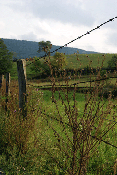
The Cottonwood Cemetery is located about one-half mile west
of Cottonwood, in Shasta County, California, on the south side of West
First Street and near the north side of Cottonwood Creek.
In the beginning in the early 187Os the land in that area belonged to
a man by the name of William Wilson and his wife Mary Wilson.
Their home was located near what is presently (1976) known as the Wilson
Reserve, (the southwest corner portion of the cemetery),
Mrs. Wilson was a full blood Indian and as was the custom in those days,
her relatives lived near them on the farm.
Mrs. Mary Wilson was the first to die in their family. She died 29 June
1874, aged 35 years and her headstone is the oldest stone in the cemetery.
Mr. Wilson buried her on the farm as was the custom in those days. And
others of the family, they were buried there also. When Mr. Wilson
died he was buried beside his wife, but many Indian relatives were buried
in this farm cemetery, besides the Wilsons. (The Wilsons have gravestones,
but many buried there do not have gravestones).
That portion, about a city block, was donated by the Wilson descendants,
as the Cottonwood Cemetery, and was called the Wilson Reserve.
Then additional land has been purchased, and the present cemetery contains
about six acres.
At one time it was decided to bury the Shasta County indigents of this
area in the Wilson Reserve, but after several attempts to do so,
they found the grave already taken. They abandoned the idea
of ever trying to bury in the Wilson Reserve portion of the cemetery again.
Mrs. Ida Ellis was on the Cemetery board over 15 years, and it
was during her time that a card file systtm was started. Mr. Arnold Brinton is the present caretaker and a good one, too.
He has cleaned all the old cemetery stones and keeps the cemetery in tip-top
condition. Ida Ellis, Vern Williams, and Rosemary McCabe bought a
Veterans stone as a Veterans memorial and the Veterans Memorial Day
services are held there each year.

TUTTLE GULCH HISTORY
By Deborah Hamby
Tuttle Gulch is located in the southwestern part of Shasta
County on the north side of the Shasta-Tehama County line. It is
an area between Gas Point and Bald Hills. Today this area of gently
rolling hills is used primarily for grazing land and for cattle and sheep.
It is sparsely populated, and there are no buildings other than homes
for the few families who live there.
Although there doesn't appear to be documented evidence
of the first exploration and settlement by white men of this area, according
to the "History and Business Directory of Shasta County" written in
1881, there was a man by the name of French Tuttle, who in early 1850 with
a group of about twelve white men crossed the North Fork of Cottonwood Creek
and explored as far south as Beegum, which would have been west of today's
Tuttle Gulch. However, because the sketch notes of this trip
were lost, it is possible that this group travelled as far east as Tuttle
Gulch or that French Tuttle returned to this region at a later time.
From my study of the markers at the Tuttle Gulch Cemetery,
I find that there were inhabitants in this region from the 1860's on.
There were several families: the Maupins, the Marx, the Drews, the Thomassons,
and the Metz. Several of these families held tracts of land into
the 1960's.
Although farming was their common livelihood, some of
these families also mined gold. As described to me by Mrs. Frankie
Morehead, who grew up in Tuttle Gulch, the families farmed and raised livestock
for their simple, everyday needs. However, when something special
was wanted, some of the men would mine for gold. She described their
life as pleasant and simple and emphasized that amounts of money were not
important to their lifestyle. There is great evidence of hydraulic
mining. Mrs. Morehead told me that this type of mining was primarily
done by Chinese who also lived in the Tuttle Gulch area. There is
no written evidence of the Chinese being there that I could find, but apparently
they had a settlement on the hillside between what is now Foster Road and
MacAuliffe Road.
From the 1860's to the turn of the century, schooling
in Tuttle Gulch went through the eighth grade. Students who wanted
to further their education moved to Chico for high school. Called
Excelsior School, the school house in Tuttle Gulch was a white one-room
building located on MacAuliffe Road. This school was only for white
students, as was the general practice of the times. The Indians usually
went uneducated, although some Indian families sent their children to a
boarding school run by the U.S. Government.
Today all that remains
of the past is Tuttle Gulch Cemetery and the washed-out gulches left by
the hydraulic mining operations.
|